Creating road segment group reports
 | Report data is calculated based on the raw 5 m data sections. |
| Only asphalt road surfaces are supported. For more information on how to create a road surface condition report of concrete roads (beta), see Creating concrete road surface condition reports (beta). |
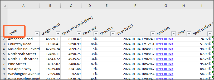
Road segment group reports present the road surface condition and distress data per road network segment as defined in the road network geometry, or grouped by specified road network metadata fields. For example, a road segment group report where parameter measurements are grouped based on road name metadata can be useful to get an overview of the condition of each individual road as a score (0–100 %), as well as a detailed breakdown of the extent of different distresses affecting the condition.
|
|
- In the main menu, go to Data.
- In the toolbar, select Filters.
- Adjust the filters to include only a specific set of data in the report.
- In the toolbar, select Lists.
- Select Videos from the drop-down list.
-
Select the videos by selecting the respective box at the beginning of the row.

To include all the videos, select . -
Select .
The Report type window opens.
- Select Road segment group report. Select Next.
- In the File format window, select a file format for the report. Select Next.
- In the Distance configuration window, select a distance unit. Select Next.
- In the Parameters window, select Road surface. All the parameters under it in the hierarchy are selected as a result. If needed, modify the selection based on your goals and preferences. Select Next.
-
In the Data
validity window, select Defaults. The default validity filters are recommended for the most accurate data. Select
Next.
Road surface condition assessment is only supported for asphalt roads. -
In the Grouping window, select a grouping method. The raw 5 m data sections can be grouped based on
road network metadata fields or on the road segments as they are defined in the road
network geometry.
Metadata fields
- When choosing a single metadata field for grouping, each row or item in the report represents data sharing the same value for that field. For example, when selecting the field 'Road class' for grouping, a row or item in the report represents all data that has the same road class.
- When choosing multiple metadata fields for grouping, each row or item in the report represents data that share a specific combination of values for those fields. For example, selecting the fields 'Region' and 'Road class', a row or item in the report represents all data that have the same region and road class.
- The order of the chosen fields determines how the rows or items are listed in the report, but does not affect the grouping itself.
- Group the data based on the road segments as they are defined in the road network geometry. Each row or item in the report represents a road network segment.
- Select Next
-
In the Aggregation window, select an aggregation method. It is recommended to use Calculate average value or Calculate weighted average value, as the resulting grouped road sections will likely be long, regardless of which
grouping method is used.
In combined data overlays, Calculate average value means, for each parameter the combined data overlay consists of, an average of extent values is calculated based on individual 5 m measurements, and then the most severe parameter exceeding its threshold value is reported.
For more information, see Combined data overlays.
For more information on the different aggregation methods, see Creating road segment interval reports. -
In the Additional options window, selecting:
- Directional: determines if the report is calculated for both driving directions separately.
- Multiple drives: combines data from multiple drives to produce even more robust results. For both driving directions, up to three different drives can be used. The maximum time difference to the latest drive is two weeks.
- Merge driving directions: combines data from opposite driving directions to create a more complete view on the road condition. The maximum time difference to the latest drive is two weeks. If disabled, only the latest data from either of the opposite driving directions, or both in the case of a directional report, is selected for each location.
-
Select Create to create the report.
A confirmation message appears. You will get a notification in Notifications and an email with a download link when the report is ready.