Jump to main content
Interpreting instance reports
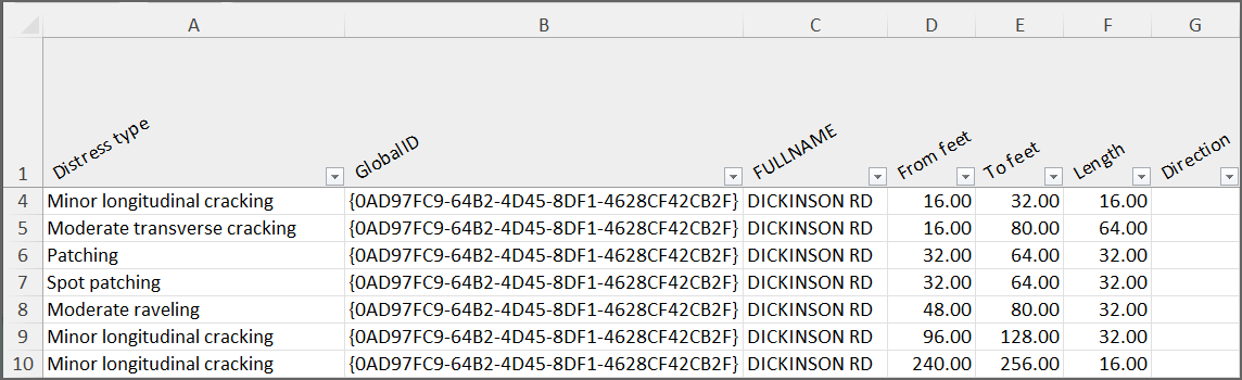
- Distress
type
- Type of detected distress, fix or other instance, depending on the selection during the
report creation
- GlobalID
- FULLNAME
- Examples of customer-specific road network metadata configurable by users with the
Admin role
- From feet
- Start chainage of the instance
- To feet
- End chainage of the instance
- Length
- Instance length
- Direction
- Driving direction (increasing or decreasing chainage), as defined in the road network
geometry
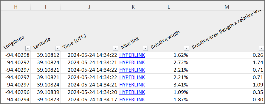
- Longitude
- Longitude coordinates (EPSG:4326)
- Latitude
- Latitude coordinates (EPSG:4326)
- Time (UTC)
- Date and time when instance was last detected
- Map link
- Direct link to RoadAI Web
- Relative
width
- Relative width of the instance
- Relative area (length x
relative width)
- Distress length multiplied by instance width