Introduction to road surface condition analysis
RoadAI produces road surface condition data according to the following process.
- Each video frame is analyzed to detect and classify all visible instances of distresses and fixed distresses.
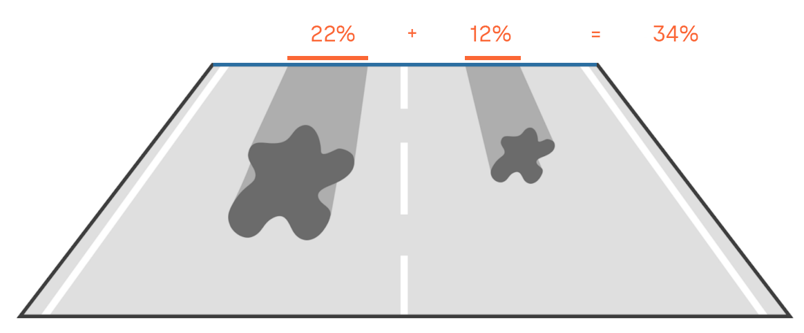
- For each instance, RoadAI measures the lateral extent and then calculates the respective extent value, which is defined as the width of the instance relative to the road width (see following figure).
- RoadAI chooses the highest extent value for each instance type present in the video frames in each 5 m section.
This raw 5 m data is then processed further for condition scores, combined data overlays, and individual distress and fix data overlays to be viewed in RoadAI Web and to be used in reports.