Interpreting line marking reports

- SECTION_RF
- USRN
- Hierarchy_
- Address 1
- Address 2
- Road TYPE
- Area
- Examples of customer-specific road network metadata
- From feet
- Start chainage of the interval or segment
- To feet
- End chainage of the interval or segment
- Length
- Interval or section length

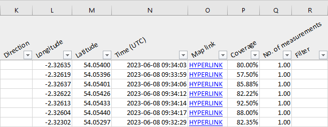
- Direction
- Driving direction (relative to road network geometry)
- Longitude
- Segment or interval starting point longitude coordinates (EPSG:4326)
- Latitude
- Segment or interval starting point latitude coordinates (EPSG:4326)
- Time (UTC)
- Time and date when line marking was last detected
- Map link
- Direct link to RoadAI Web
- Coverage (total)
- How much of the section was covered
- No. of measurements
- How many different drives' measurements were used (not necessarily a whole number
because of continuous weighting between measurements from different drives)
When merging multiple drives together, the time window is two weeks from the most recent video. If the default filters are on, the weather conditions do not affect the weighting because all the data with bad conditions is left out from the report. - Filter
- The filters remove data collected in wet weather, on non-asphalt surfaces or in poor lighting conditions. The Filter column shows why data was removed. For example, it might show Surface condition if the road was wet or Surface type if the road was not asphalt.

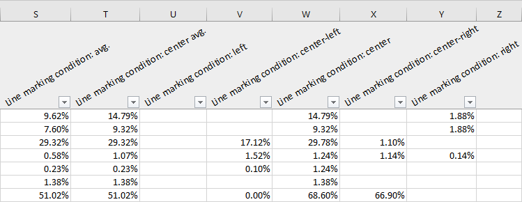
- Line marking condition: avg.
- Line marking condition: center avg.
- Line marking condition: left
- Line marking condition: center-left
- Line marking condition: center-right
- Line marking condition: right
- Condition score of the line marking: 0% means heavily erased, 100% means in perfect condition

