Using the polygon tool
 | The polygon tool does not filter the road sections within the polygon area. |
 | A report with Excel as the file type will include all data from the video clips filtered with the polygon tool and visible in the list view, including the road segments outside the polygon area. |
 | Reports with Shapefile or GeoJSON as the file type are limited to the area within the polygon, and include data for all the defined road sections in the road network geometry that are present within the polygon area. The data is available for the whole section, even if just part of it is within the polygon area. |
- In the main menu, go to Data.
-
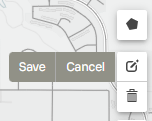
Select the polygon drawing tool on the right side of the map.

- Select as many points on the map as needed to create the desired shape. To finish drawing and close the polygon, select the first point again.
-
To edit the polygon, select the polygon editing tool, right under the polygon drawing
tool.

- Drag the points on the map to edit the polygon's shape.
- Select Save.
- To delete the polygon, select the trash bin icon.
