Jump to main content
Interpreting surface marking reports

- Last detected
(UTC)
- Time and date when surface marking was last detected
- Label
- Surface marking label ID
- Name
- Surface marking label name
- Code
- Surface marking label code
- Category
- Surface marking label category
- Additional
info
- Additional information on surface marking label
- Condition
- Overall condition of the surface marking assigned by user, rating from 1 (worst) to 5
(best)
- Action
- Action assigned by user (Ok, Monitor, Refresh)
- Tags
- Labels attached by user to a surface marking for identification or additional
information
- Text
- Text written by user
- Map link
- Direct link to RoadAI Web

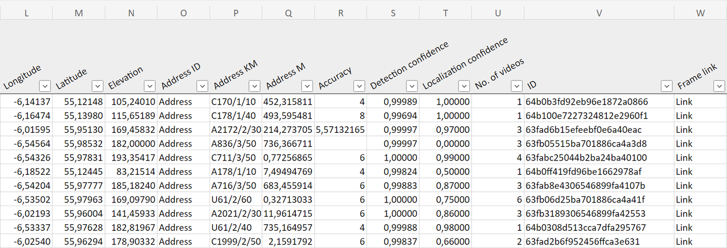
- Longitude
- Longitude coordinates (EPSG:4326)
- Latitude
- Latitude coordinates (EPSG:4326)
- Elevation
- Elevation from sea level in meters
- Address ID
- High level address (road ID)
- Address KM
- Medium level address (road section ID)
- Address M
- Address meters
- Accuracy
- Phone's GPS accuracy when the last detection was made
- Detection
confidence
- How confident the detection is accurate, ranging from 0 (worst) to 1 (best)
- Localization
confidence
- How confident the localization is accurate, ranging from 0 (worst) to 1 (best)
- No. of videos
- Total number of videos the object was detected from
- ID
- Unique object ID
- Frame link
- Direct link to the video frame from which the object was last detected


