Specific location on the road network that is defined with one or several road network
metadata values and a chainage value to create a unique combination.
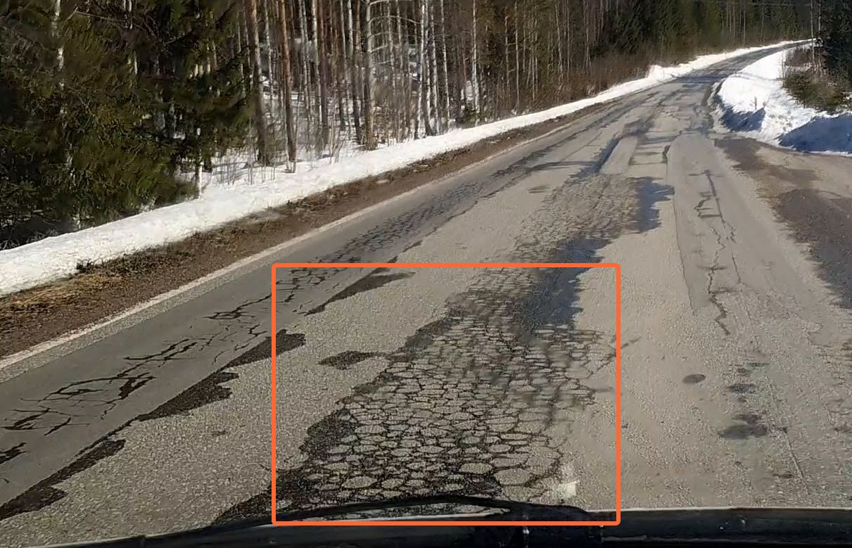
alligator cracking
Series of interconnecting parallel longitudinal cracks forming a pattern like the skin
of an alligator.
annotation
User-generated markings or notes (text, audio, or picture) on a map.
area patching
Rectangular mend of road surface replaced with new material to repair the existing surface.
basemap
The basemap provides geographical context and content to the map. The RoadAI basemaps
are: Light, Light terrain, Dark, Streets, and Satellite.
binder bleeding
A possibly sticky film of asphalt binder that creates a smooth, shiny, reflecting
surface appears on the road surface.
block cracking
Interconnected cracks form large rectangular patterns.
chainage
A modeled line corresponding to the center of a straight road used to measure distance.
In RoadAI, it is used for determining the direction of the drive. The start and end points, and
therefore the direction of the road, depend on how the road geometry is drawn.
chainage offset
By default, chainage will be zero at the start of a road segment. A metadata field in
the road network geometry can be used to apply an offset to each road section, so that the
chainage may be something other than zero at the start of a road segment.
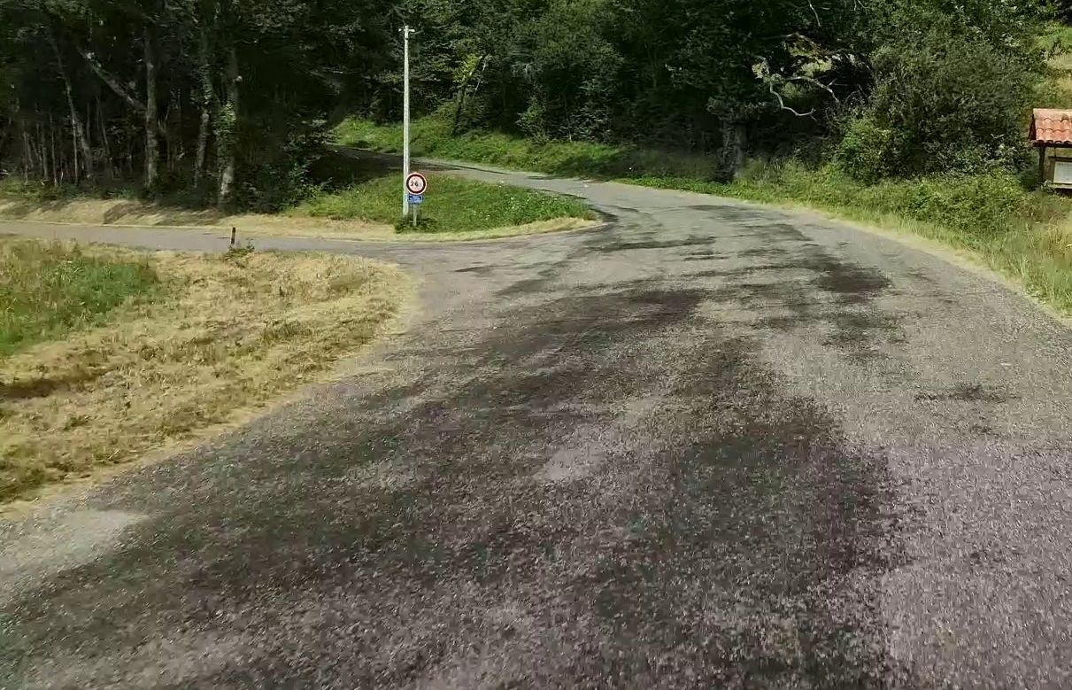
chipping loss
A surface-level distress where fine aggregates and chippings detach from the asphalt’s
top layer. This results in a visibly coarse or uneven texture, although the pavement’s
structural layers remain unaffected.
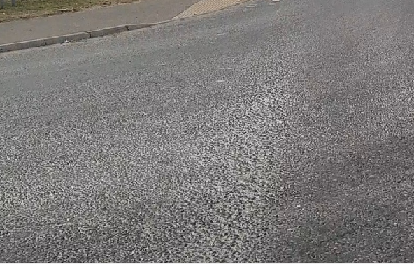
chipsealing
Process of spraying the road with hot bitumen, then covering with stone chippings which
are rolled into the bitumen.
data overlay
Data visualized as a color-coded layer on top of Road network and Videos feature layers (road surface condition score, video age, structural distresses, and
similar).
dedicated device
Mobile phone restricted for RoadAI data collection only.
defective asphalt overlay
A surface-level distress where the asphalt overlay detaches from the underlying concrete
pavement. This results in cracking, delamination, and localized material loss, often exposing
the previous surface.
distress
The road experiences a decline in its condition or structural load-carrying
capacity.
distress severity value
The severity of a distress is defined by its lateral extent (width relative to the road
width).
edge deterioration
Distresses like cracking, raveling, deformation, chippings, or potholes on the edge of
the road (right or left edge deterioration).
feature layer
Feature layers are used to display a variety of data on the map. The RoadAI feature
layers include, for example, Road network, Annotations, and similar.
footway
Path for pedestrian use.
high friction surface
Road surface treated to restore or enhance friction to reduce accidents. The coating
provides extra friction and sustains a high level of friction over time, also on wet
roads.
high friction surface
deterioration
Wearing off of the high friction surface coating.
line data
Data with string of coordinates that extend from point A to B with customizable
length.
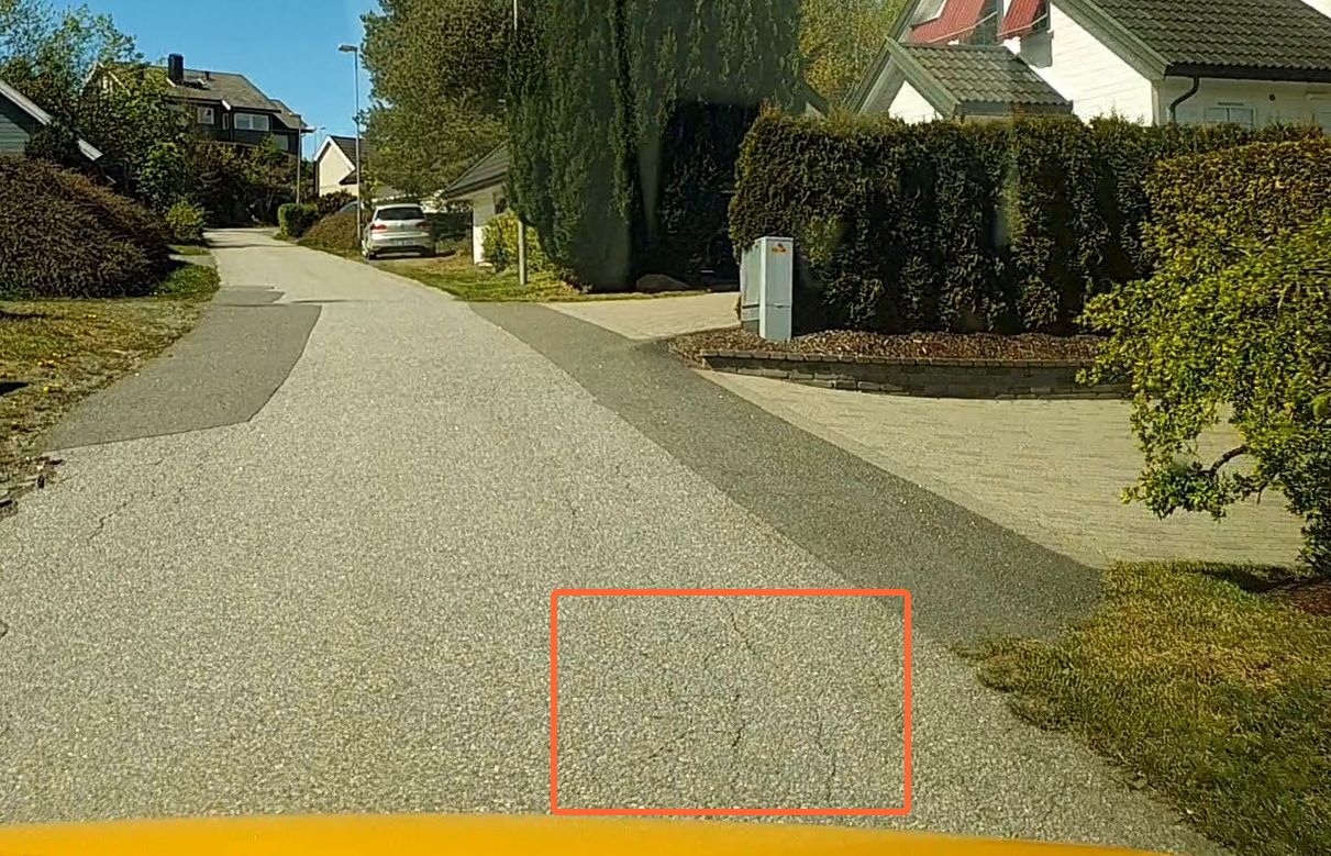
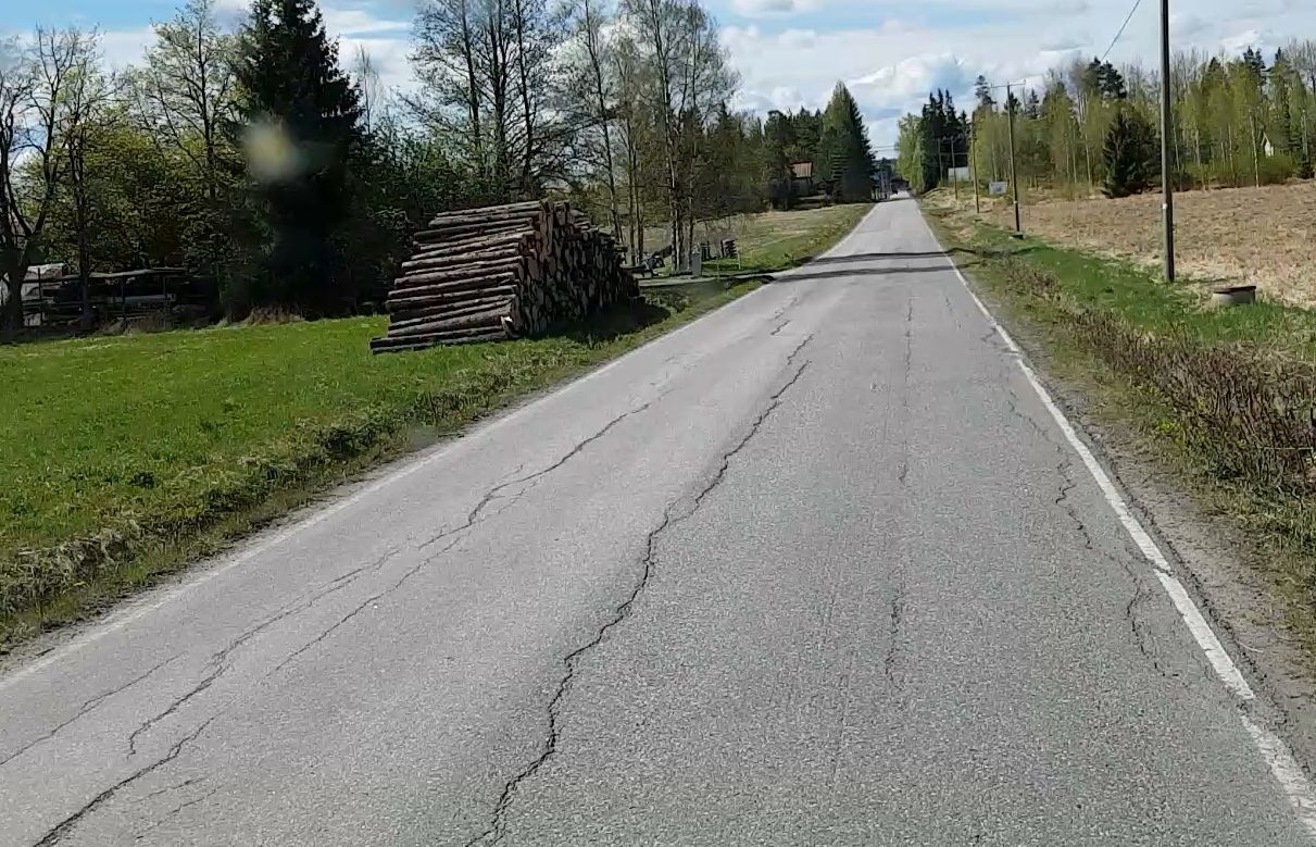
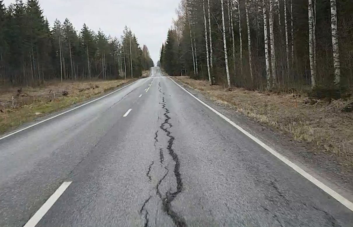
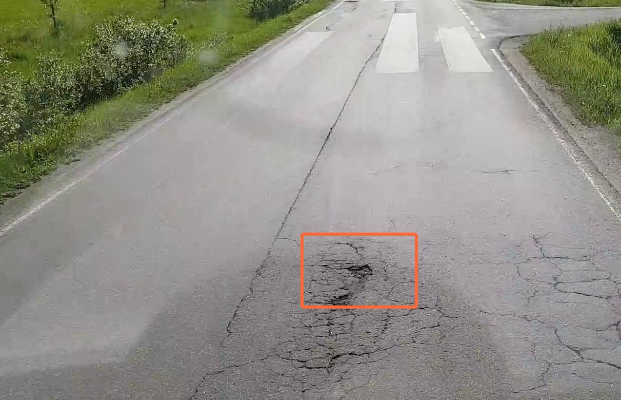
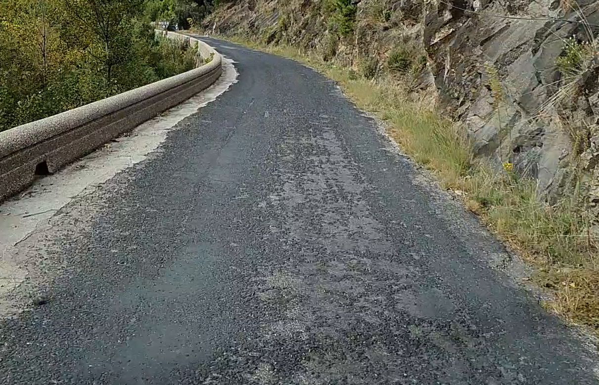
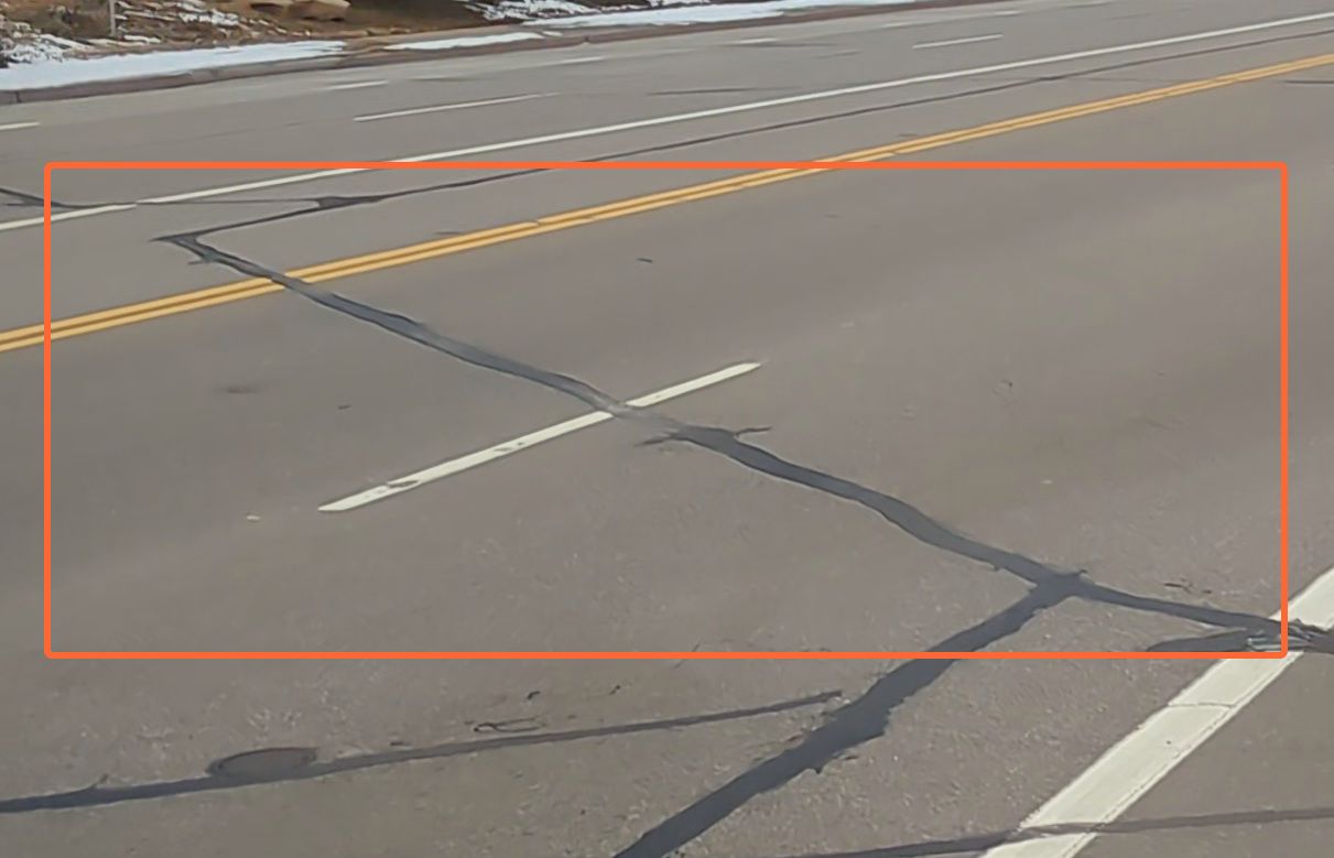
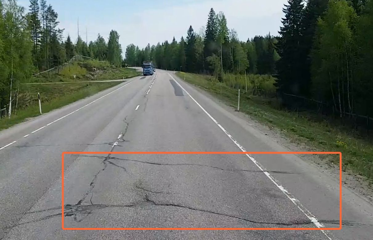
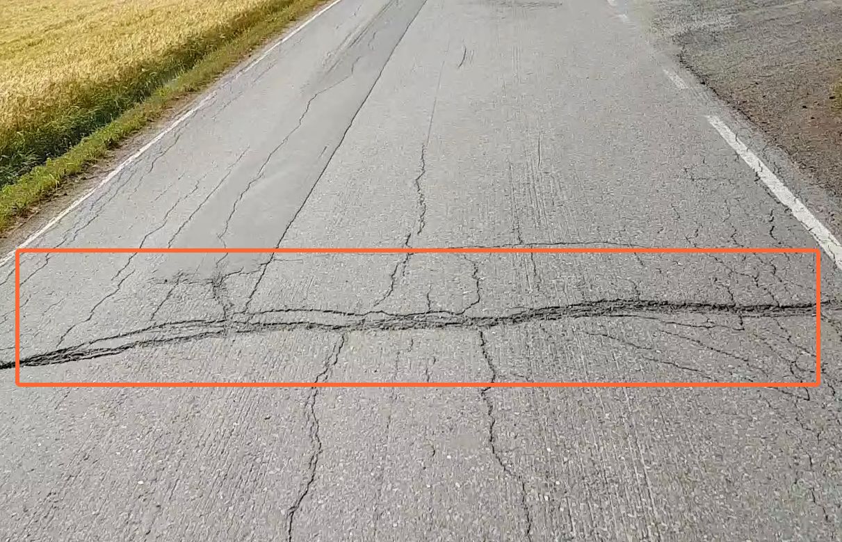
longitudinal cracking
Load- or thermally-induced crevices that run along the road.Figure 1. Minor longitudinal crackingFigure 2. Moderate longitudinal crackingFigure 3. Severe longitudinal cracking
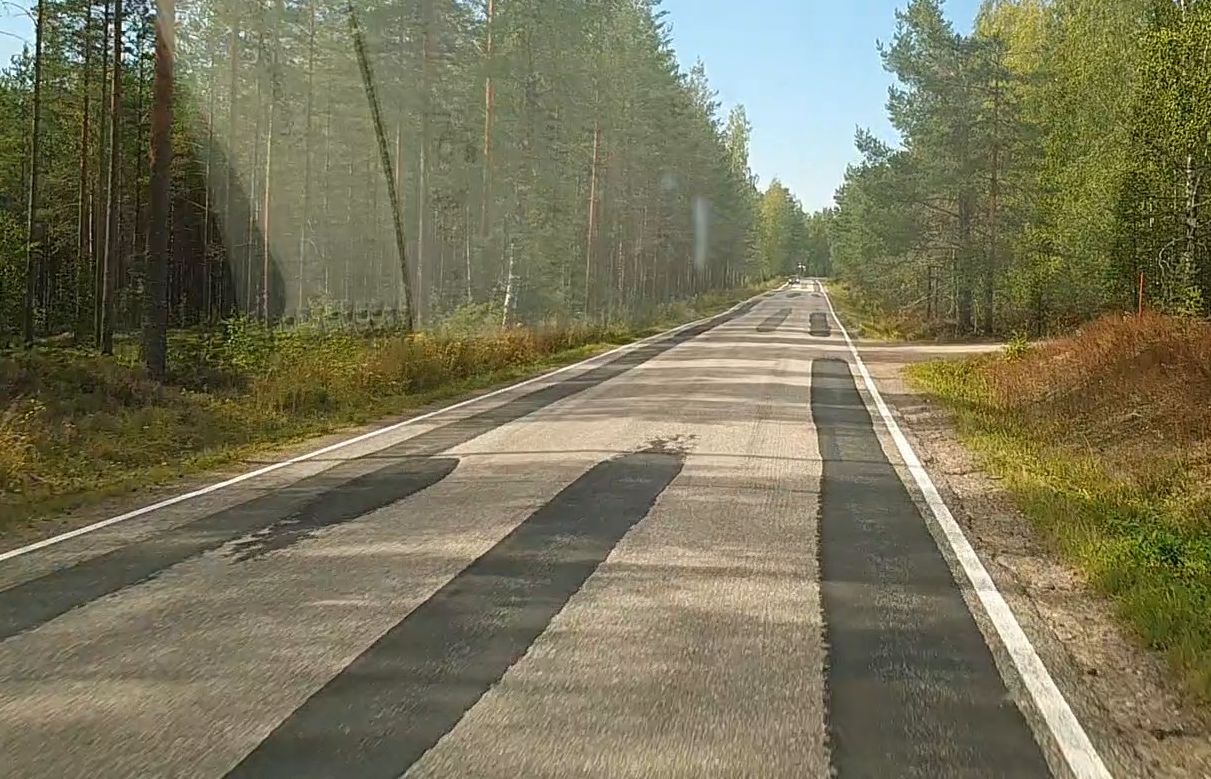
machine surfacing
A process of removing a portion of the asphalt on a road and overlaying it with a new
layer of asphalt.
manhole
Opening large enough for a person to pass through that is used as an access point for an
underground vault or pipe covered by a removable plate forming the lid.
point data
Data positioned with a single set of coordinates.
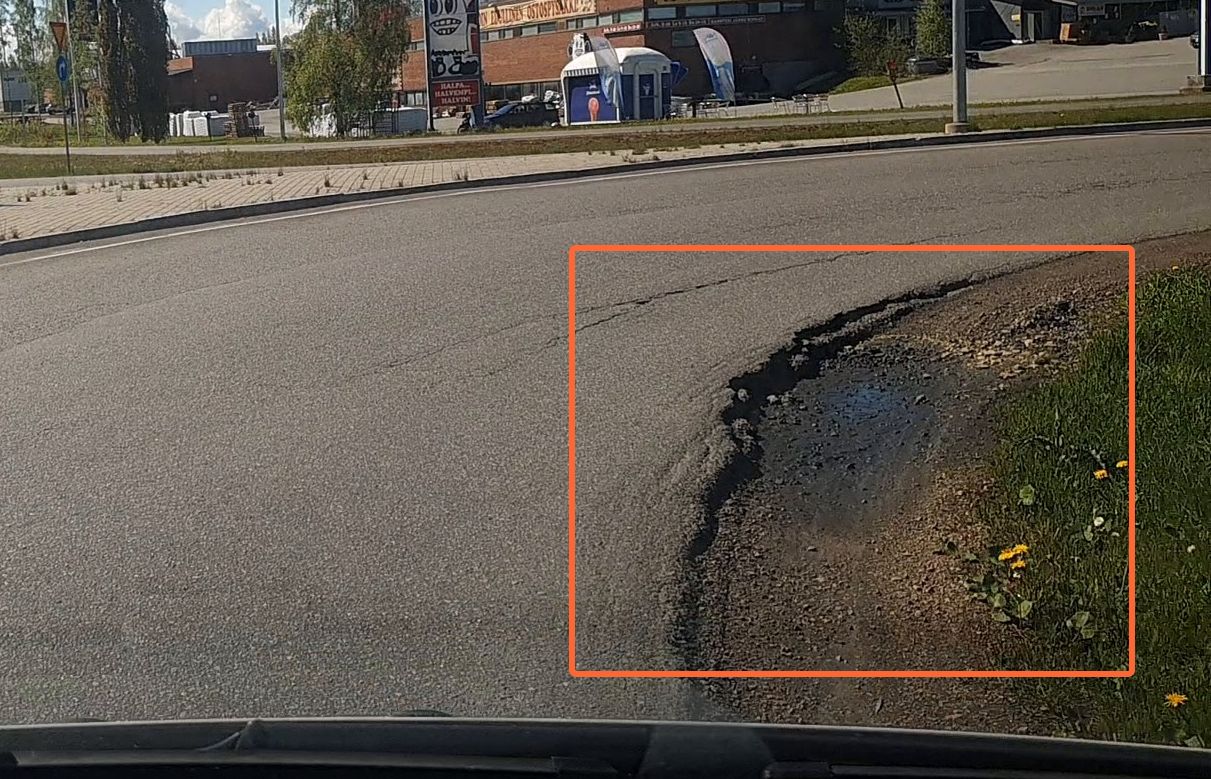
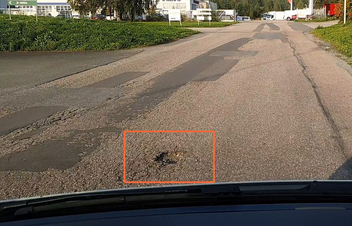
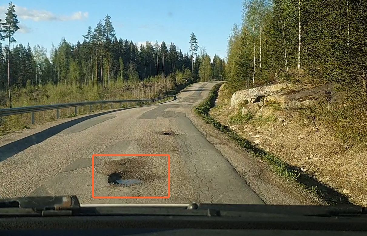
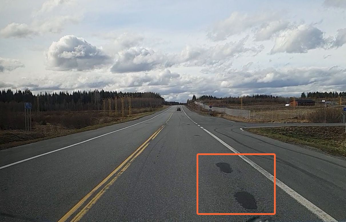
pothole
Loss of road surface material resulting in a bowl-shaped depression of varying severity.Figure 4. Minor potholeFigure 5. Moderate potholeFigure 6. Severe pothole
raveling, moderate
A condition where the surface appears rough and aged due to significant loss of fine
aggregates. The wearing course is heavily eroded, and the binder or base layer may be exposed,
though still structurally sound. This indicates ongoing surface deterioration without structural
compromise.
raveling, severe
An advanced condition that features a very rough, pitted surface with extensive loss of
both aggregates and binder. The underlying layers may show signs of damage, including
disintegration or deformation.
reconstruction
A process of removing the existing road surface, reconstructing or rehabilitating the
road bed, and placing the new road surface.
road asset
The road itself, and everything on and next to it, excluding buildings, people, cars,
and trees. Road asset examples include guard rails, concrete borders, storm drains, manholes,
safety bollards, surface markings, and similar.
road network geometry
A road network geometry is the shape and arrangement of the physical elements of a road
system.
road network geometry file
A file containing the information of the road network geometry (shapefile, GeoJSON, or
similar).
road network metadata
Data associated with road segments as they are defined in the road network geometry. For
example, road class, road surface type, address, and similar.
road segment
A unique stretch of road defined in the road network geometry. It goes from point A to
point B (intersections, for example). It can be shorter or longer, depending on how it is
defined in the geometry. It is a model of the road segment center line and consists of an
ordered collection of points.
road segment interval
Road segments are split into regular road segment intervals to report shorter road
segments (as opposed to whole road segments).
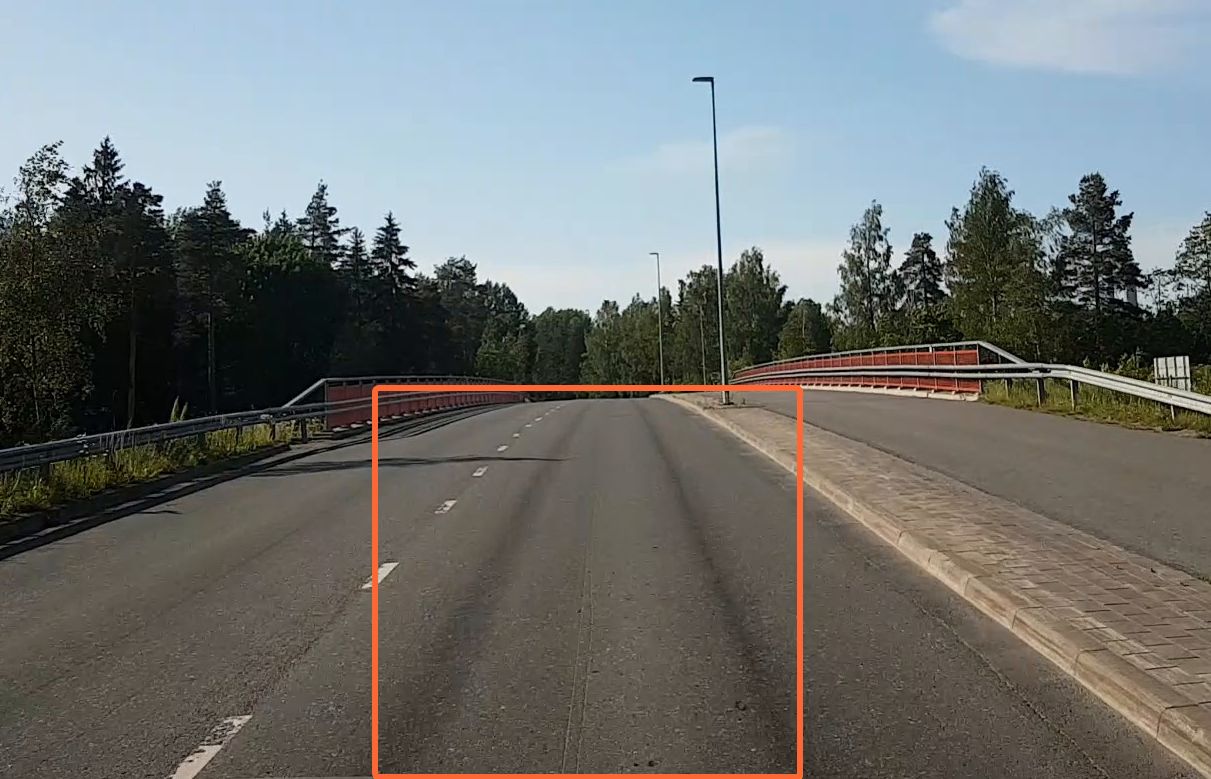
road surface
The visible top layer of the road analyzed by RoadAI. From left edge to right
edge.
road surface condition class
The condition class is a rating from 1 to 5, depending on the condition score. By
default, 1 = 0-20%, 2 = 21-40%, etc.
road surface condition score
The condition score indicates the overall condition of the road surface on a scale from
0 to 100. The higher the score, the better the condition.
rutting
Permanent, longitudinal surface depression that occurs in the wheel paths of a flexible
asphalt road surface due to the passage of traffic, or possibly caused by weak asphalt mixture.
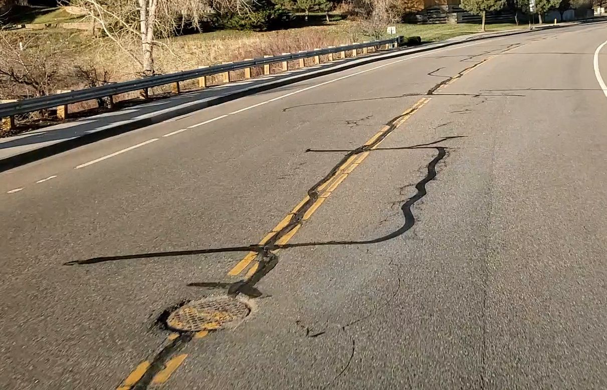
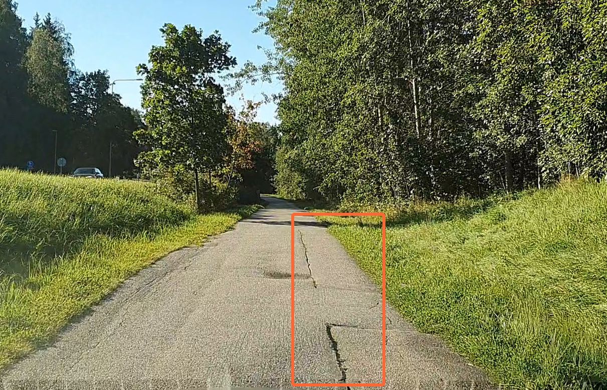
sealing
Cracks across or along the road that have been filled with specialized adhesive sealant
to prevent the intrusion of water and incompressible material into the cracks and to reinforce
the adjacent road surface.Figure 7. Longitudinal sealingFigure 8. Transverse sealing
spot patching
Small fix of road distress by applying a tack coat of binder or other filler material
directly into it to make it even with the rest of the road.
storm drain
Storm drains divert water from the streets and other paved surfaces into the
sewers.
structural distress
Distress affecting the road structure. In RoadAI, it is a data overlay combining edge
deterioration, alligator cracking and subsidence.
subsidence
Localized depression of the asphalt producing a difference in level.
surface distress
Distress affecting the road surface. In RoadAI, it is a data overlay combining moderate
and severe transverse tracking, moderate and severe longitudinal cracking, binder bleeding and
severe raveling.
surface marking
Official information conveyed by markings on the road surface.
tag
Labels attached to videos and point objects, such as traffic signs and annotations, for
the purpose of identification or to give other additional information.
third-party road asset management
system
Third-party system into which RoadAI data (and data from other sources) is uploaded to
achieve road maintenance work planning, budgeting, and deterioration modeling.
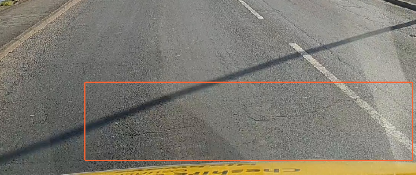
transverse cracking
Load- or thermally-induced crevices that run horizontally on the road.Figure 9. Minor transverse crackingFigure 10. Moderate transverse crackingFigure 11. Severe transverse cracking
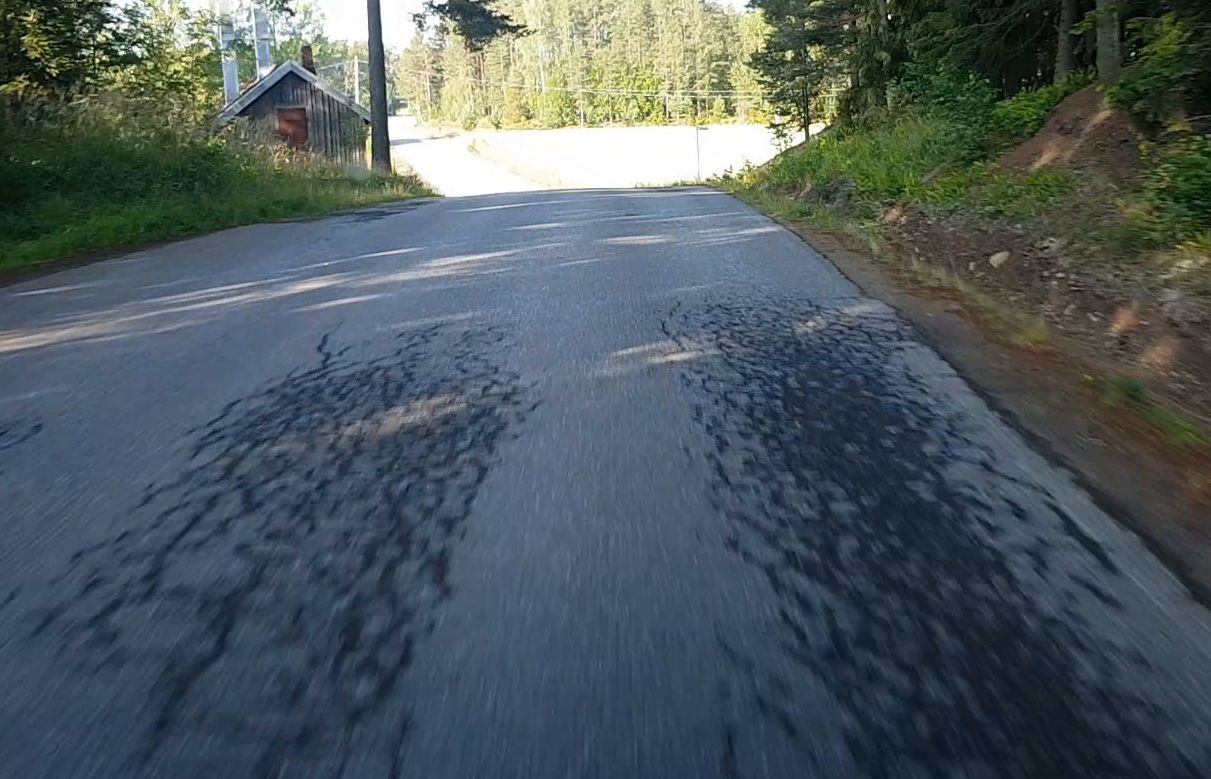
wheel track cracking
Combined category of any sort of cracking on the wheel tracks.Figure 12. Wheel track cracking of alligator
cracking type