Jump to main content
Interpreting annotation reports
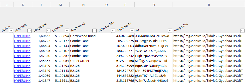
Excel annotation reports

- Created at
(UTC)
- Date and time when the annotation was created
- Recorded at
(UTC)
- Date and time when the footage or content of the annotation was recorded
- Resolved at
(UTC)
- Date and time when the annotation status was set to Closed.
- Tags
- Labels attached by user to an annotation for identification or additional
information
- Text
- Text written by user
- User
- User who recorded the footage or content of the annotation
- Author
- Username of the annotation author
- Type
-
- Point annotation: Point annotation
in a video
- Line annotation: Continuous annotation in a video
- Image: Standalone image (not from a video)
- Panorama: Panorama image
- Condition
- Rating from 1 to 5

- Action
- Action assigned by user (OK, Fix, Replace, Missing)
- Map link
- Direct link to RoadAI Web
- Longitude
- Longitude coordinates (EPSG:4326)
- Latitude
- Latitude coordinates (EPSG:4326)
- Address ID
- High level address (for example, road ID)
- Address KM
- Medium level address (for example, road section ID)
- Address M
- Address meters
- ID
- Unique object ID
- Image link
- Direct link to the image
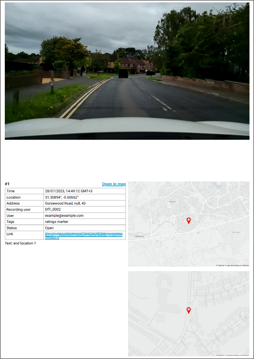
PDF annotation reports

- Time
- Date and time when the annotation was created
- Location
- Longitude and latitude coordinates (EPSG:4326)
- Address
- Example of customer-specific road network metadata
- Recording user
- User who recorded the footage or content of the annotation
- User
- Username of the annotation author
- Tags
- Labels attached by user to an annotation for identification or additional
information
- Status
- The status of annotations can be set to Open or Closed
- Link
- Direct link to map view in RoadAI


